- Over 90% of the ocean floor remains unmapped in detail, hindering our understanding of Earth’s climate, geology, and biodiversity.
- Autonomous sensors are emerging as the key to unlocking the dark, high-pressure world beneath the waves.
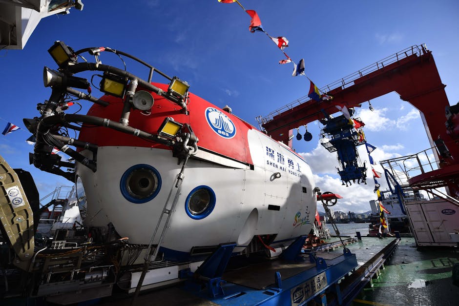
- Advances in AUVs, sonar imaging, and artificial intelligence enable faster and more precise ocean mapping.
- Autonomous sensors can dive deep, operate for weeks, and systematically scan the seafloor with precision.
- The goal of mapping the entire ocean floor by the end of this decade is now within reach thanks to new technologies.
What lies beneath the ocean’s surface has remained one of the last great mysteries of our planet. Despite decades of scientific exploration, over 90% of the ocean floor remains unmapped in detail. With vast stretches of the seabed still unknown, researchers are asking: How can we understand Earth’s climate, geology, and biodiversity if we can’t see the foundation of half the planet? The answer, increasingly, lies in autonomous sensors—robotic systems capable of navigating the deep sea, collecting high-resolution data, and transmitting it without human intervention. These technologies are now emerging as the key to unlocking the dark, high-pressure world beneath the waves.
Can Technology Map What Humans Cannot Reach?

Yes—thanks to advances in autonomous underwater vehicles (AUVs), sonar imaging, and artificial intelligence. Traditional ocean mapping relied on ship-based sonar, a slow and expensive method that covers limited ground. Autonomous sensors, however, can dive deep, operate for weeks at a time, and systematically scan the seafloor with precision. Equipped with multibeam echosounders and inertial navigation systems, these robots create detailed bathymetric maps even in the absence of GPS signals. Projects like the Nippon Foundation-GEBCO Seabed 2030 initiative are harnessing this technology with the goal of mapping the entire ocean floor by the end of this decade—a feat previously deemed impossible. These sensors are not only faster but also safer and more cost-effective than crewed expeditions.
What Evidence Supports This Technological Shift?

Recent deployments have demonstrated the power of autonomous ocean mapping. In 2023, the autonomous vessel Maxlimer, operated by SEA-KIT International, surveyed over 2,000 square kilometers of the Pacific Ocean for the Seabed 2030 project, identifying previously unknown seamounts and ridges. Meanwhile, the U.S. Navy and academic institutions have tested AI-guided AUVs that adapt their routes in real time to focus on geologically interesting features. According to BBC News, data from these missions has already improved tsunami prediction models by clarifying underwater fault lines. The General Bathymetric Chart of the Oceans (GEBCO) reports that the volume of high-resolution seafloor data has increased by more than 40% since 2020, largely due to autonomous systems. These tools are also aiding in the discovery of hydrothermal vents and deep-sea ecosystems, expanding our understanding of life in extreme environments.
Are There Skeptics or Limitations to This Approach?

Despite the promise, challenges remain. Some oceanographers caution that autonomous sensors, while efficient, can miss subtle biological or geological nuances that human-led missions might detect. Battery life, communication delays, and the risk of losing multimillion-dollar vehicles in extreme depths are ongoing concerns. Additionally, data interpretation requires skilled analysts, and the sheer volume of information generated can overwhelm current processing pipelines. There are also geopolitical and ethical considerations: who owns the data collected in international waters, and how might it be used for resource extraction or military surveillance? As Nature highlighted, while automation accelerates mapping, it must be paired with transparent governance and international collaboration to ensure equitable and sustainable outcomes.
What Real-World Impacts Are Already Emerging?

The practical benefits are already being felt. Accurate seafloor maps are critical for laying undersea internet cables, avoiding hazards in shipping lanes, and planning offshore wind farms. In environmental science, detailed bathymetry improves ocean circulation models, which are essential for predicting climate change impacts. After the 2022 Hunga Tonga eruption, rapid mapping by autonomous systems helped scientists assess tsunami risks and submarine landslides. Conservation efforts also benefit: marine protected areas can now be designed with precise knowledge of seafloor habitats. Furthermore, nations are using this data to extend their maritime economic zones under the United Nations Convention on the Law of the Sea (UNCLOS), underscoring the geopolitical weight of ocean mapping.
What This Means For You
Even if you never see the ocean floor, the data being collected affects your life. Better climate models mean more accurate weather forecasts and sea-level rise predictions. Safer shipping and communication infrastructure reduce costs and improve global connectivity. As autonomous sensors expand our knowledge, they empower society to make informed decisions about conservation, energy, and disaster preparedness. The deep sea may seem remote, but its mapping is shaping policies and technologies that ripple across economies and ecosystems.
Still, questions linger: How do we balance scientific exploration with the protection of vulnerable deep-sea habitats? And as AI takes the helm, how much autonomy should we grant machines in exploring—and potentially exploiting—Earth’s final frontier?
Source: News