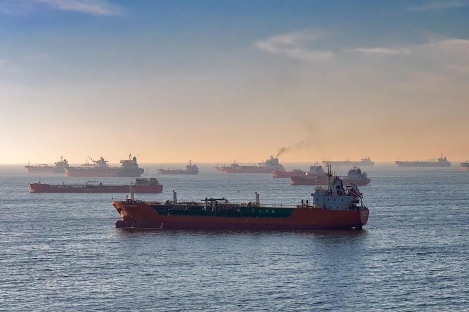
- Iran has expanded its territorial sea claim in the Strait of Hormuz by 50%, sparking tensions with the UAE and Oman.
- The move extends Iran’s maritime boundary up to 12 nautical miles, double the internationally recognized 6-mile limit.
- The Strait of Hormuz is a critical chokepoint in global energy trade, with 17 million barrels of crude oil passing through daily.
- Iran’s new map could influence insurance rates, naval deployments, and the global energy market as a whole.
- Five GCC states have jointly notified the IMO that they will not recognize Iran’s unilateral claims.
Iran has formally asserted jurisdiction over a significantly expanded zone in the Strait of Hormuz, including waters historically recognized as belonging to the United Arab Emirates and Oman, reigniting long-simmering regional tensions. The move, detailed in a revised nautical chart released by Iran’s Ports and Maritime Organization, extends Tehran’s claimed maritime boundary up to 12 nautical miles—double the internationally recognized 6-mile limit—deep into the shipping lanes that carry nearly 20% of the world’s oil. Five Gulf Cooperation Council (GCC) states have jointly notified the International Maritime Organization (IMO) that they will not recognize Iran’s unilateral claims, warning commercial vessels against complying with any demands from Iranian authorities within these contested waters. The development marks a sharp escalation in Iran’s maritime posture at a time of heightened geopolitical volatility in the Persian Gulf.
Strategic Waters, Rising Stakes

The Strait of Hormuz, a 21-mile-wide waterway separating Iran from the Arabian Peninsula, is one of the most critical chokepoints in global energy trade, with an estimated 17 million barrels of crude oil passing through daily. Control over even a fraction of this corridor carries immense strategic weight, influencing everything from insurance rates to naval deployments. Iran’s new map, which extends its territorial sea claim beyond the bounds set by the United Nations Convention on the Law of the Sea (UNCLOS), appears to be a deliberate effort to assert dominance over navigation routes used by vessels bound for Dubai, Fujairah, and Muscat. Analysts at the International Institute for Strategic Studies (IISS) warn that Tehran’s actions are part of a broader pattern of incremental expansion—what some call “salami-slicing” tactics—aimed at normalizing control over disputed zones without triggering outright military confrontation.
A Map That Redefines Boundaries

The revised Iranian maritime chart, disseminated to domestic shipping agencies and port authorities in early April, repositions the baseline for Iran’s territorial waters further southward, encompassing areas around the Greater and Lesser Tunb islands and approaching the coast of Ras al-Khaimah in the UAE. These islands, seized by Iran in 1971 amid British withdrawal from the Gulf, remain a flashpoint in Emirati-Iranian relations, with the UAE maintaining a formal claim to sovereignty. The new demarcation also intrudes into waters near the Omani port of Dibba, a key logistical hub outside the Strait. While Iran is not a signatory to UNCLOS, most of the world—including the U.S. and GCC states—recognizes its provisions as customary international law. By unilaterally altering its maritime boundaries, Tehran challenges not only bilateral agreements but the foundational legal framework governing maritime conduct.
Legal and Military Implications

International maritime law permits coastal states to claim up to 12 nautical miles of territorial waters, but such claims must be based on defined baselines and respect overlapping rights of neighboring states. Iran’s new map appears to disregard these principles, particularly in areas where maritime boundaries are not formally demarcated. Legal experts at the BBC have noted that unilateral extensions without bilateral negotiation or international arbitration violate Article 15 of UNCLOS, which governs boundary delimitation in the absence of treaties. The move could empower Iranian naval and Revolutionary Guard units to intercept foreign vessels, issue fines, or even seize ships under the guise of enforcing sovereign rights. Such actions risk miscalculation, particularly given the presence of U.S. Fifth Fleet operations in nearby Bahrain and frequent transits by Western commercial fleets.
Regional and Global Repercussions

The immediate impact of Iran’s claims falls most heavily on shipping companies, insurers, and port operators navigating the Strait. The joint GCC-IMO notification urges vessels to continue operating under established international routing protocols and to report any interference by Iranian forces. However, the ambiguity created by competing claims increases operational risk and could lead to higher insurance premiums for tankers and cargo ships. Beyond commerce, the dispute threatens to deepen rifts within the Gulf, undermining recent diplomatic efforts to normalize ties between Iran and Arab states. Oman, traditionally a mediator in regional conflicts, has refrained from public condemnation but is believed to have registered diplomatic protests through backchannel talks. For global powers, the situation underscores the fragility of maritime order in contested zones, where legal norms are increasingly challenged by assertive state behavior.
Expert Perspectives
“Iran is testing the limits of what it can claim without triggering a military response,” says Dr. Sanam Vakil, deputy director of the Middle East North Africa program at Chatham House. “This is not just about geography—it’s about signaling strength domestically and strategically confusing adversaries.” Others, like retired U.S. Navy Captain James Fanell, argue the move reflects a coordinated strategy by the Islamic Revolutionary Guard Corps (IRGC) to control chokepoints and leverage energy flows. However, some analysts caution against overreaction, noting that Iran may be seeking to strengthen its bargaining position ahead of potential nuclear negotiations. “These claims are maximalist, but they’re also negotiable,” says a Gulf-based diplomat speaking on condition of anonymity.
What happens next depends on how consistently Iran enforces its new boundaries and whether the international community responds with coordinated diplomatic or economic measures. The IMO is unlikely to issue a ruling without bilateral submissions, leaving the dispute in legal limbo. Meanwhile, surveillance data from commercial satellite providers show increased Iranian patrol activity near the new claimed zones. As global demand for energy security rises, the world will be watching whether a narrow strait becomes the flashpoint for a broader crisis.
Source: Euronews