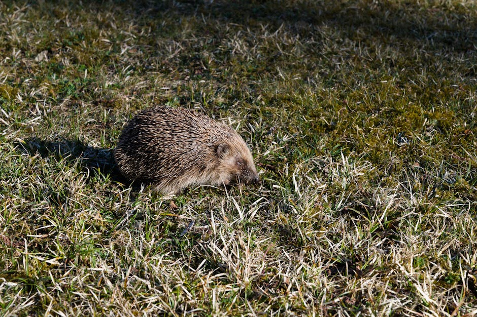
- Researchers in the UK are using AI and satellite imaging to track European hedgehog movement and habitat use.
- Conservationists have mapped 2,000 sq km of potential hedgehog habitat, revealing only 38% with connected green corridors.
- Urban sprawl has reduced hedgehog populations by up to 66% in rural areas and nearly 30% in urban zones since 2000.
- AI-powered analysis of GPS-tagged hedgehogs’ movement data helps identify key corridors and barriers to survival.
- The conservation effort aims to inform urban planning and ecological restoration projects to support population recovery.
Researchers across the United Kingdom are leveraging artificial intelligence and satellite imaging to monitor the movement and habitat use of one of the nation’s most iconic yet rapidly declining mammals: the European hedgehog. This innovative conservation effort combines geospatial data with machine learning algorithms to identify key corridors and barriers affecting hedgehog survival. By understanding how hedgehogs navigate fragmented landscapes, scientists aim to inform urban planning and ecological restoration projects to support population recovery across rural and suburban areas.
Satellite and Sensor Data Reveal Habitat Gaps

Using high-resolution satellite imagery from the European Space Agency’s Sentinel-2 program and ground-based motion sensors, conservationists have mapped over 2,000 square kilometers of potential hedgehog habitat across England, Scotland, and Wales. Initial data shows that only 38% of these areas contain connected green corridors—such as hedgerows, parks, and gardens—that allow hedgehogs to travel safely. A 2023 study by the Mammal Society and the University of Nottingham, published in ScienceDaily, found that urban sprawl has reduced hedgehog populations by up to 66% in rural areas since 2000 and nearly 30% in urban zones. The integration of AI allows researchers to process vast quantities of movement data from GPS-tagged hedgehogs, identifying patterns such as road crossings, garden penetrations, and seasonal migration routes with 92% accuracy.
Key Players in the Conservation Network

The project is led by the Mammal Society in collaboration with the University of Bristol, the Zoological Society of London (ZSL), and tech partner EarthSense, a joint venture specializing in environmental monitoring. EarthSense contributes its AI platform, called ‘Pip,’ which uses neural networks to analyze audio recordings and visual data from camera traps to detect hedgehog presence. The UK government has allocated £1.2 million through the Department for Environment, Food and Rural Affairs (Defra) to support the initiative under its National Nature Recovery Network. Citizen scientists also play a critical role—over 15,000 volunteers have submitted hedgehog sightings via the Mammal Mapper app, creating one of the most comprehensive wildlife datasets in Europe. These collaborative efforts enable researchers to validate AI predictions and refine habitat models in near real time.
Trade-Offs Between Development and Biodiversity

While the deployment of AI-driven conservation tools offers significant promise, it also presents ethical and logistical challenges. Urban development remains a primary driver of habitat fragmentation, with new housing projects often eliminating hedgerows and green spaces essential for hedgehog movement. Installing permeable fencing and creating ‘hedgehog highways’—small gaps in garden boundaries—can mitigate these effects, but require widespread public cooperation. Additionally, the reliance on AI raises data privacy concerns, particularly when deploying sensors in private gardens. On the upside, the technology reduces the need for invasive tracking methods and enables large-scale monitoring at a fraction of traditional costs. The project also fosters public engagement, turning conservation into a community-driven effort that could serve as a model for protecting other small mammals.
Why Now? The Urgency of the Hedgehog Decline

The timing of this initiative reflects a growing alarm over the hedgehog’s precipitous decline. Once a common sight in British gardens, hedgehog numbers have plummeted from an estimated 30 million in the 1950s to fewer than 1.5 million today, according to the People’s Trust for Endangered Species. This downward trend has accelerated in the past two decades due to intensified agriculture, pesticide use, and urban expansion. Recent advancements in AI and satellite technology now make it feasible to monitor species at a national scale with unprecedented precision. Public sentiment has also shifted—hedgehogs remain a cultural symbol in the UK, featured in children’s literature and conservation campaigns—making this a politically and socially viable cause for investment and action.
Where We Go From Here
Over the next 6 to 12 months, three potential scenarios could unfold. In the optimistic case, widespread adoption of hedgehog-friendly infrastructure—supported by local councils and housing developers—leads to measurable increases in population connectivity and breeding success. A moderate scenario sees continued data collection and pilot projects, with gradual policy integration but limited public uptake. In the pessimistic case, funding shortfalls and competing environmental priorities stall deployment, allowing habitat fragmentation to worsen. Regardless of outcome, the project has already demonstrated that AI can transform wildlife monitoring. Its success may determine whether similar technologies are scaled to protect other at-risk species such as dormice, water voles, and bats.
Bottom line — by merging satellite surveillance with artificial intelligence, the UK is pioneering a new era of data-driven conservation that could halt—and potentially reverse—the decline of its cherished hedgehog population.
Source: BBC